
Study suggests offshore oil and gas production in Gulf of Mexico has higher methane loss rates than typical onshore production
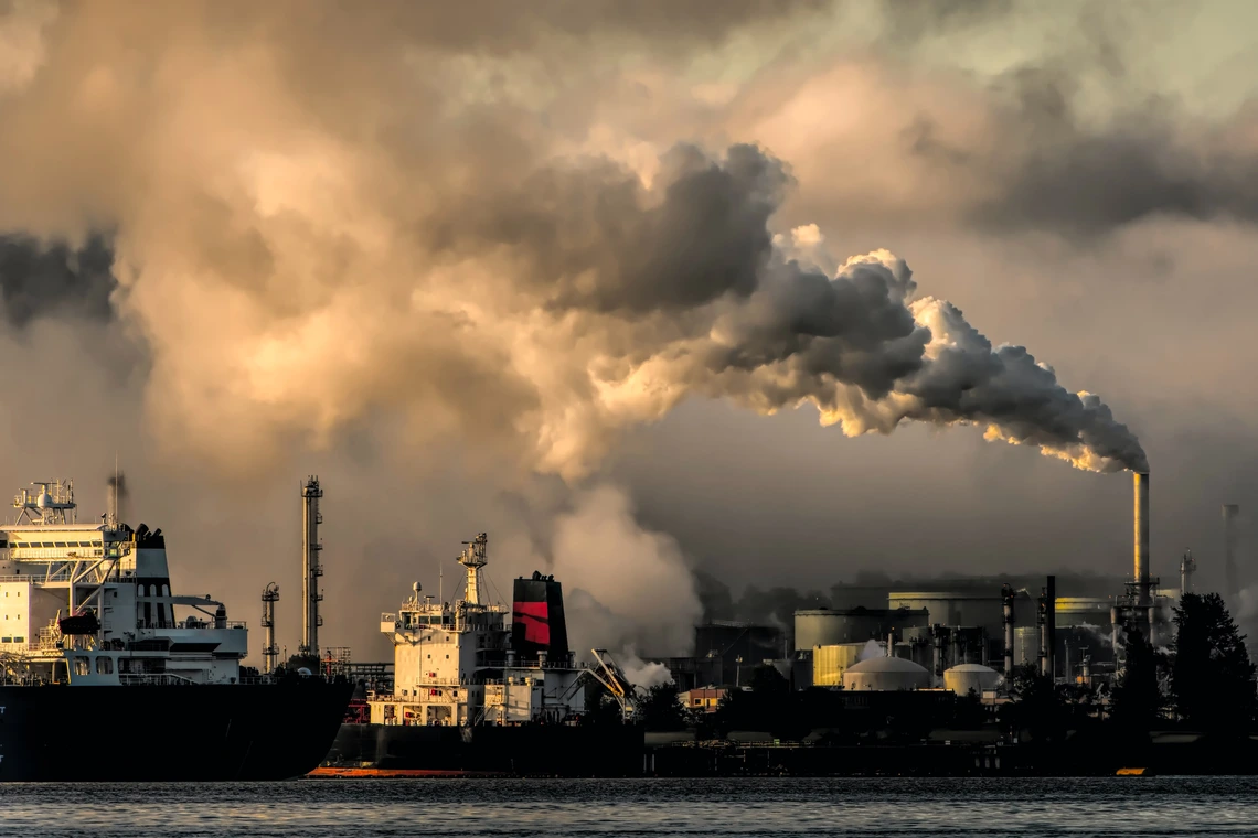
August 11, 2022—Pasadena, CA—Today, Carbon Mapper released the findings of airborne observations in Spring and Fall 2021 of 151 shallow water offshore oil and gas platforms in U.S. state and federal waters in the Gulf of Mexico. Researchers found that the methane loss rate from these shallow water sources is significantly higher than typical onshore production and disproportionally contributes to climate change—providing a potential focus for sustained monitoring and mitigation efforts.
Specifically, the team calculated a methane loss rate (defined as the observed emissions normalized to reported natural gas production) of 23-66% from shallow offshore Gulf of Mexico operations compared to 3.3-3.7% reported by other studies of operations in the Permian basin. The team plans to conduct additional surveys of the broader population of plaforms in the Gulf and selected international offshore production areas with aircraft and satellites to assess overall methane loss rates.
This study penned by researchers at Carbon Mapper, University of Arizona, NASA’s Jet Propulsion Laboratory, University of Michigan, and Arizona State University is the first systematic application of a remote emissions-sensing technology that can detect methane emissions over water, and attribute methane emissions to specific infrastructure.
Offshore oil and natural gas platforms are responsible for about 30% of global oil and gas production. Despite the large share, few studies have directly measured atmospheric methane emanating from these platforms due to their remote location compared to onshore production, and technological challenges of observing methane emissions over water (the dark surface limits the sun’s reflection hindering methane measurements). These factors present unique challenges for oil and gas leak detection and repair programs and may undermine society’s ability to meet methane reduction targets such as the Global Methane Pledge. Remote sensing via aircraft or satellite—adapted for offshore conditions—may provide a powerful way to close this observational gap.
“Bottom-up estimates and gaps in observational data can result in significant undercounting of emissions from offshore oil and gas infrastructure,” said Dr. Alana Ayasse, Research Scientist with Carbon Mapper, and the University of Arizona. “This study underscores the importance of increased transparency and sustained remote monitoring in offshore oil- and gas-producing regions to inform mitigation action.”
Specific findings include:
- Many observed shallow-water offshore platforms and surrounding infrastructure exhibited super-emitter activity. Of the 151 targeted platforms and surrounding areas surveyed between Spring and Fall, 62 pieces of infrastructure had an observable methane plume (over 10 kg/hr).
- Emissions from observed offshore sources were highly persistent. The offshore sources measured in this study were over twice as persistent—meaning how frequently emissions were detected at a given location—as methane emissions from onshore oil and gas infrastructure reported by other studies. Researchers revisited many of these platforms multiple times in Spring and Fall of 2021 which provided an initial characterization of source persistence, and further observations will evaluate whether there is a long-term trend.
- Specific types of equipment were responsible for a disproportionate number of emissions. Using high resolution imaging, the researcher attributed observed emissions primarily to tanks, satellite wells, pipelines, and vent booms that were visually identifiable—showing that a small number of observable emissions sources were responsible for a majority of the methane released into the atmosphere.
The infrastructure observed were distributed evenly across state and federal waters, allowing the team to sample different regulatory structures.
“Remote sensing of methane over onshore oil and gas fields has transformed our understanding of emissions and highlighted mitigation possibilities,” said Eric Kort, Associate Professor of Climate and Space Sciences and Engineering University of Michigan. “By demonstrating these similar remote sensing capabilities for offshore infrastructure, this work opens the door to similarly impactful advances for this large and often neglected segment of the fossil fuel industry.”
Demonstrating the technical capabilities to remotely observe methane emissions from offshore oil and gas infrastructure is an important precursor to the future launch of the hyperspectral satellite constellation being developed in partnership with Carbon Mapper, Planet Labs PBC, and NASA JPL which will be able to provide more sustained and high frequency observations over wider geographic areas. Insights from emissions data captured from offshore oil and gas platforms will be increasingly relevant as global demand for liquified natural gas grows, and offshore oil and gas leases are expanded.
The imaging spectrometer used in the study, Arizona State University’s Global Airborne Observatory, is able to pinpoint methane sources to within about 15 feet (5m) while flying at 18,000 ft. When methane emission plumes were detected, researchers used a high-resolution camera to relate the plumes to individual pieces of equipment.
Download the full study here. https://iopscience.iop.org/article/10.1088/1748-9326/ac8566